


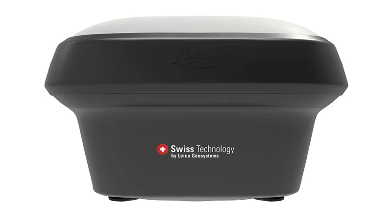
Leica GS18/T/I GNSS RTK Rover Smart Antenna Series
The world’s fastest GNSS RTK rover
Introducing the world’s fastest and easiest-to-use GNSS RTK rover, the Leica GS18 T. Now you can measure any point faster and easier without the need to hold the pole vertical.
This latest innovation combines the GNSS and inertial measurement unit (IMU) being the first true tilt compensation solution that is immune to magnetic disturbances and is calibration-free. The GS18 T works directly out of the box.
Save up to 20 percent over conventional surveying practices due to the fact that no time is wasted by leveling the bubble. Focus on your surroundings and not the bubble to measure points that previously could not be measured. Avoid time-consuming auxiliary methods with true tilt compensated surveying. You will stake out more efficiently and conveniently than ever before with increased speed, safety, and comfort. Watching the bubble is simply no longer needed.
The GS18 T GNSS RTK rover is part of the Leica Geosystems self-learning GNSS series. It seamlessly combines with Leica Captivate field software and Leica Infinity office software, continuing the powerful and immersive Leica Captivate Experience.
Leica GS18 T antenna offers a world of possibilities like never before in the area of complex measurements and setups in difficult environments. It combines all the advantages of the Leica Viva GS16 antenna (including the first RTK+ smart managing technology) with the inertial measurement unit to be the first true tilt compensation solution immune to magnetic disturbances and it is calibration-free.
Contact Us for Best Price
Description
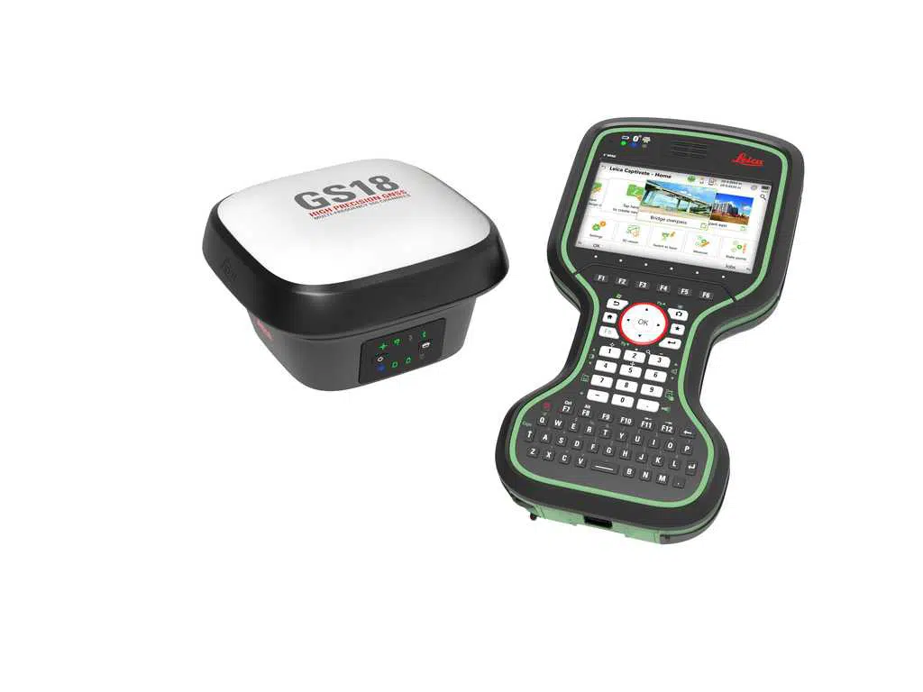
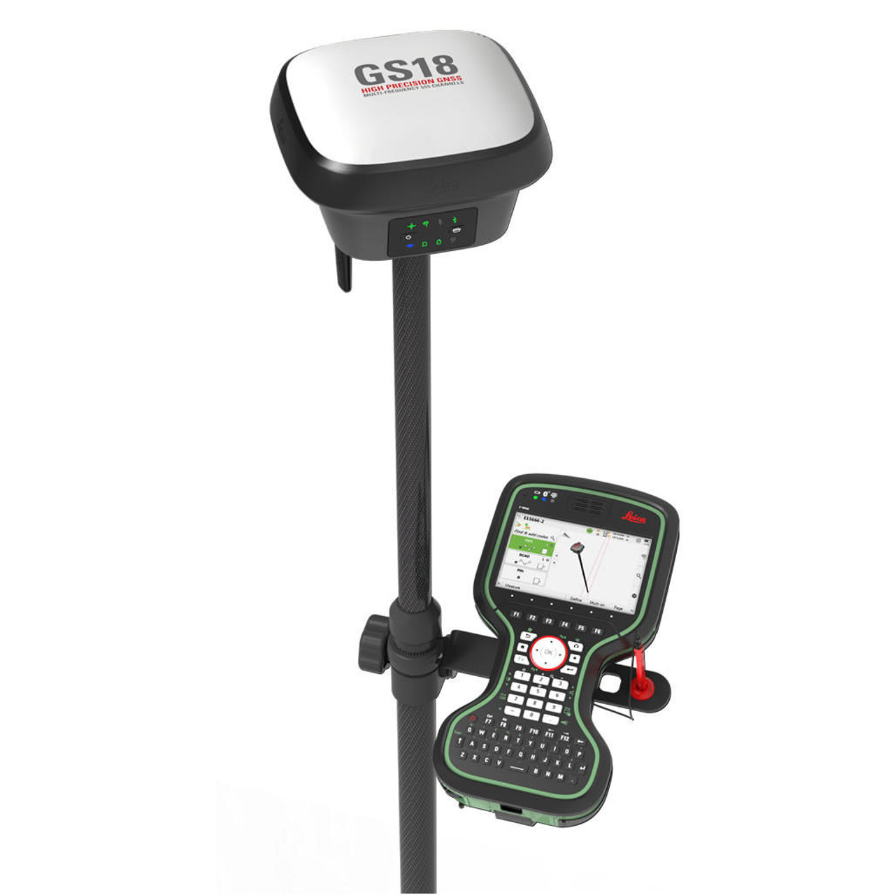
The GNSS smart antenna that grows with your business

The Leica GS18 is a self-learning GNSS smart antenna. It’s an excellent companion to a surveyor that primarily works with a network RTK such as HxGN SmartNet. Like most of the Leica Geosystems GNSS smart antennas, the GS18 works as a rover and a base.
Three Models to choose from:
 Leica GS18
The GS18 smart antenna that grows with your business: upgrade it to tilt-compensated rover at any time.

Leica GS18 T
Fast and easy-to-use GNSS RTK rover that has been exceeding expectations since 2017. The original truly tilt compensating GNSS solution that is immune to magnetic disturbances and is calibration-free.

Leica GS18 I
Versatile, survey-grade GNSS RTK rover with Visual Positioning. Capture the site in images and measure points from them, either in the field or later in the office.
TILT COMPENSATION UPGRADE
Whenever you need the efficiency and safety improvements gained from tilted measurements, upgrade your GS18 to a tilt compensating rover. Any Leica Geosystems service can do the upgrade at any time.
IMPROVED PERFORMANCE
Multipath reduction and interference mitigation options in Captivate boost GNSS signal tracking quality under harsh environments, which improves RTK availability and accuracy. Also, an interference toolkit will enable filtering to remove in- and out-of-band distortions for even more robust GNSS signal tracking.
ENGAGING SOFTWARE
The Leica Captivate field software is the perfect companion for the GS18. With easy-to-use apps, all measured and design data can be viewed and used, providing you with a clear understanding of your data in 2D and 3D view. Captivate spans industries and applications with little more than a simple tap, regardless of whether you work with GNSS, total stations or both.
4G LTE & EXCELLENT MEASUREMENT QUALITY
Tracking multi-frequency signals comes as a standard to all Leica Geosystems GS sensors. Combined with an excellent GNSS antenna element and a position update rate of 20 Hz, the GS18 ensures reliable measurement quality.
INTERNAL MEMORY
Users with any GS18 model have the flexibility to log raw data into an SD card or the internal memory.
Specification
| Leica GS18 I GNSS RTK Rover | |||
|---|---|---|---|
| GNSS TECHNOLOGY | |||
| Self-learning GNSS | Leica RTKplus | Adaptive on-the-fly satellite selection | |
| SmartLink (worldwide correction service) | Remote precise point positioning (3 cm 2D)1 Initial convergence to full accuracy typically 18 min, Re-convergence < 1 min |
||
| SmartLink fill (worldwide correction service) | Bridging of RTK outages up to 10 min (3 cm 2D)1 | ||
| Leica SmartCheck | Continuous check of RTK solution | Reliability 99.99% | |
| Signal tracking | GPS (L1, L2,L2C,L5), GLONASS (L1, L2, L2c, L32) BeiDou (L1, L2 B1I, B2I, B2a, B3I), Galileo (E1, E5a, E5b, Alt-BOC, E62) QZSS (L1, L2C, L5, L62), NavIC (L53), SBAS (WASS, EGNOS, MSAS, GAGAN), L-Band | ||
| Number of channels | 555 (more signals, fast acquisition, high sensitivity) | ||
| Tilt compensation | Increase measurement productivity and traceability | Calibration-free Immune to magnetic disturbance | |
| IMAGING | |||
| Camera | Sensor | Global shutter with 1.2 MP | |
| Field of view (HZ / V) | 80° / 60° | ||
| Frame rate | 20 Hz | ||
| Image group capture | 2 Hz capturing rate | Max. capturing time: 60 s Size of an image group with a 60 s capturing time: appr. 50 MB | |
| Working range | 2 m – 10 m distance to object of interest | ||
| Point cloud | Leica Infinity | Derive point cloud from an image group | |
| MEASURMENT PERFORMANCE & ACCURACY4 | |||
| Time for initialisation | Typically 4 s | ||
| Real-time kinematic (Compliant to ISO17123-8 standard) | Single baseline | Hz 8 mm + 1 ppm / V 15 mm + 1 ppm | |
| Network RTK | Hz 8 mm + 0.5 ppm / V 15 mm + 0.5 ppm | ||
| Real-time kinematic tilt compensated | Topographic points (not for static control points) | Additional Hz pole tip uncertainty typically les than 8 mm + 0.4 mm/° tilt down to 30° tilt | |
| Post processing | Static (phase) with long observations | Hz 3 mm + 0.1 ppm / V 3.5 mm + 0.4 ppm | |
| Static and rapid static (phase) | Hz 3mm + 0.5 ppm / V 5 mm + 0.5 ppm | ||
| Code differential | DPGS / RTCM | Typically 25 cm | |
| Image point measurement | 1-tap measurement in field/office | Typically 3 cm – 5 cm (3D)1 | |
| COMMUNICATIONS | |||
| Communication ports | Lemo | USB and RS232 serial | |
| Bluetooth® | Bluetooth® v2.1 + EDR, class 1.5 | ||
| WLAN | 802.11 b/g for field controller communication only | ||
| Communication protocols | RTK data protocols | Leica, Leica 4G, CMR, CMR+, RTCM 2.2, 2.3., 3.0, 3.1, 3.2 MSM | |
| NMEA output | NMEA 0183 v4.00 and Leica proprietary | ||
| Network RTK | VRS, FKP, iMAX, MAC (RTCM SC 104) | ||
| Built-in LTE modem | LTE frequency bands | Penta Band (20, 8, 3, 7, 1) / Penta Band (13, 17, 5, 4, 2)5 | |
| UMTS frequency bands | Tri Band (900/1800/2100 MHz) / Tri Band (1700/1900/2100 MHz)5 | ||
| GSM frequency bands | Dual Band (900/1800 MHz / Quad Band (850/900/1800/1900 MHz)5 | ||
| Built-in UHF modem | Receive & transmit UHF radio modem | 403 – 473 MHz, channel spacing 12.5 kHz, 20 kHz, 25 kHz, max. 1 W output power up to 28800 bps over air | |
| External data links | Generic serial interface for phone modems and UHF/VHF radio modems | ||


Reviews
There are no reviews yet.